Available at Amazon!
Pair the book with:

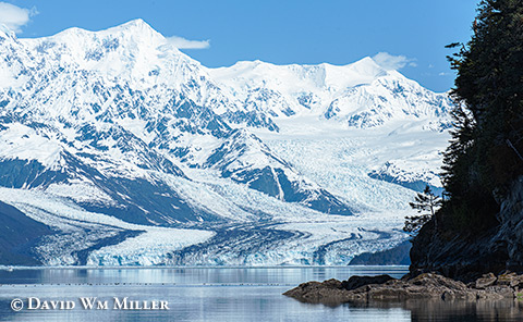
Evidence of ancient moraines and fluctuating tidewater glaciers display an icy chronology up and down College Fiord.

The glacier names used in College Fiord follow an academic theme established by three early research expeditions that documented glacial conditions from 1899 to 1910. Notably, glaciers named for historically women's universities flow down the west shore while those named for men's universities dominate the east shore.
College Fiord's tidewater glaciers have been especially dynamic. Glaciers associated with the Pleistocene's Cordilleran ice sheet filled College Fiord 7,680 years ago. Subsequent retreats resulted in the fiord being entirely ice-free, then re-advancing and once again blocking the fiord’s mouth 2,470 years ago. Subsequent glacial retreats left a series of moraines up the fjord. Recent glacial advances associated with the Little Ice Age began around 1633, followed by retreats beginning in the 1800s. Currently, Harvard Glacier, at the head of College Fjord, is among Alaska's few tidewater glaciers that continue to advance.

Excerpt from Exploring Alaska's Western Prince William Sound:
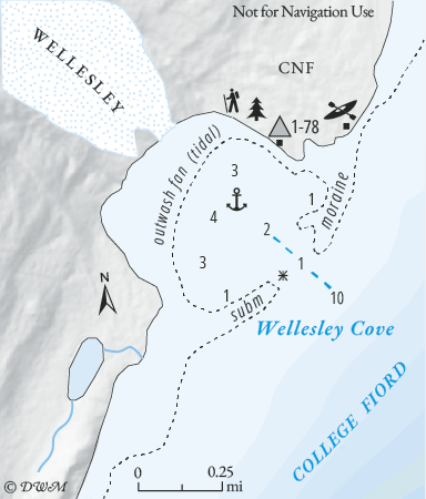
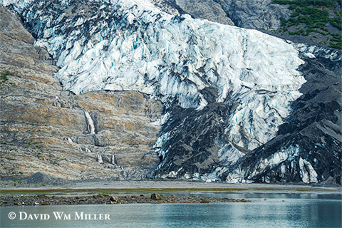
"Wellesley Glacier is the first tidewater glacier encountered while traveling up College Fiord. The glacier’s terminus sits at the head of a 0.5 mi wide shallow cove fronted by a partially submerged moraine. Either side of the inlet has adequate camping areas, especially on the N side of the cove."
"The broad areas of bare rock and young vegetation bordering the glacier’s margins give evidence of recent thinning. Piles of gravel (push moraines) sit on moraine's N side. As of 2023, Wellesley Glacier continues to be considered tidewater because upper tidal stages can reach the ice terminus, which also fluctuates."

"Moraine shoals and a rock awash nearly block Wellesley Cove’s entrance, leaving a narrow, 1 fm deep channel across the moraine. Only shallow-draft boats should attempt entering the cove, preferably at higher tides."
"Tidal flats extend nearly 0.25 mi off the cove’s head, with wide tidal margins along the shore. Bottom depths reach 4 fms near the cove’s middle. To enter, (See Map) steer a course a little N of mid-channel to navigate between the rock awash, on the port side (0.4 mi off the S entrance point) and the moraine shoal pinching the channel from the N shore, starboard side."
To learn more about boating, kayaking, and camping destinations in College Fiord and hundreds of other sites in the Western Sound, order Exploring Alaska's Western Prince William Sound (paperback or Epub) at Amazon, Google Play or at Apple Books.


